Five contiguous claims, 100 km north of Kamloops
Historical copper-gold showings
Soil samples in the project-wide survey begun in Sept. 2026
Sources: Brutus Mining Inc. news release, Oct. 19, 2026, reviewed and approved by Luke van der Meer, P.Geo., Qualified Person; NI 43-101 Technical Report on the CW Property (D. Strickland, P.Geo., effective Jan. 6, 2026).
McCarthy, Honeymoon, Queen Bess, Axel 1 and Axel 2: copper-gold, some with silver, lead and zinc, in the Eagle Bay Assemblage and Fennell Formation.
A reported 73 tonnes of ore mined and shipped from 1917 to 1919, recovering 52,222 g of silver, 13,789 kg of lead and 12,503 kg of zinc.
The discovery trench returned 6.6 m at 1.1% Cu, including 1.0 m at 2.24% Cu and 0.315 g/t Au. A grab sample from Trench C assayed 9.35% Cu and 0.411 g/t Au.
785 soil and 35 rock samples, prospecting, mapping and 11.1 line-km of ground magnetics. Rock samples returned trace to 4.91% Cu.
Past operators include Noranda (1972), Kerr Addison (1988), Teck (1992 to 1993), Vendetta (2008 to 2009) and Black Mountain (2010 to 2012).
Sources: Brutus Mining Inc. news release, Oct. 19, 2026, reviewed and approved by Luke van der Meer, P.Geo., Qualified Person; NI 43-101 Technical Report on the CW Property (D. Strickland, P.Geo., effective Jan. 6, 2026).
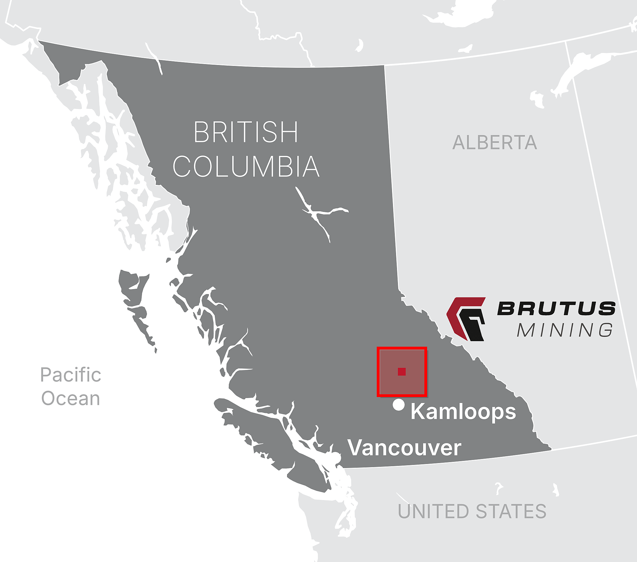
Of Kamloops, BC
Year-round access
Kamloops population, regional mining hub
Highway 5 and existing forest service roads. Kamloops is a mining hub with exploration services and contractors.
*Click to expand image
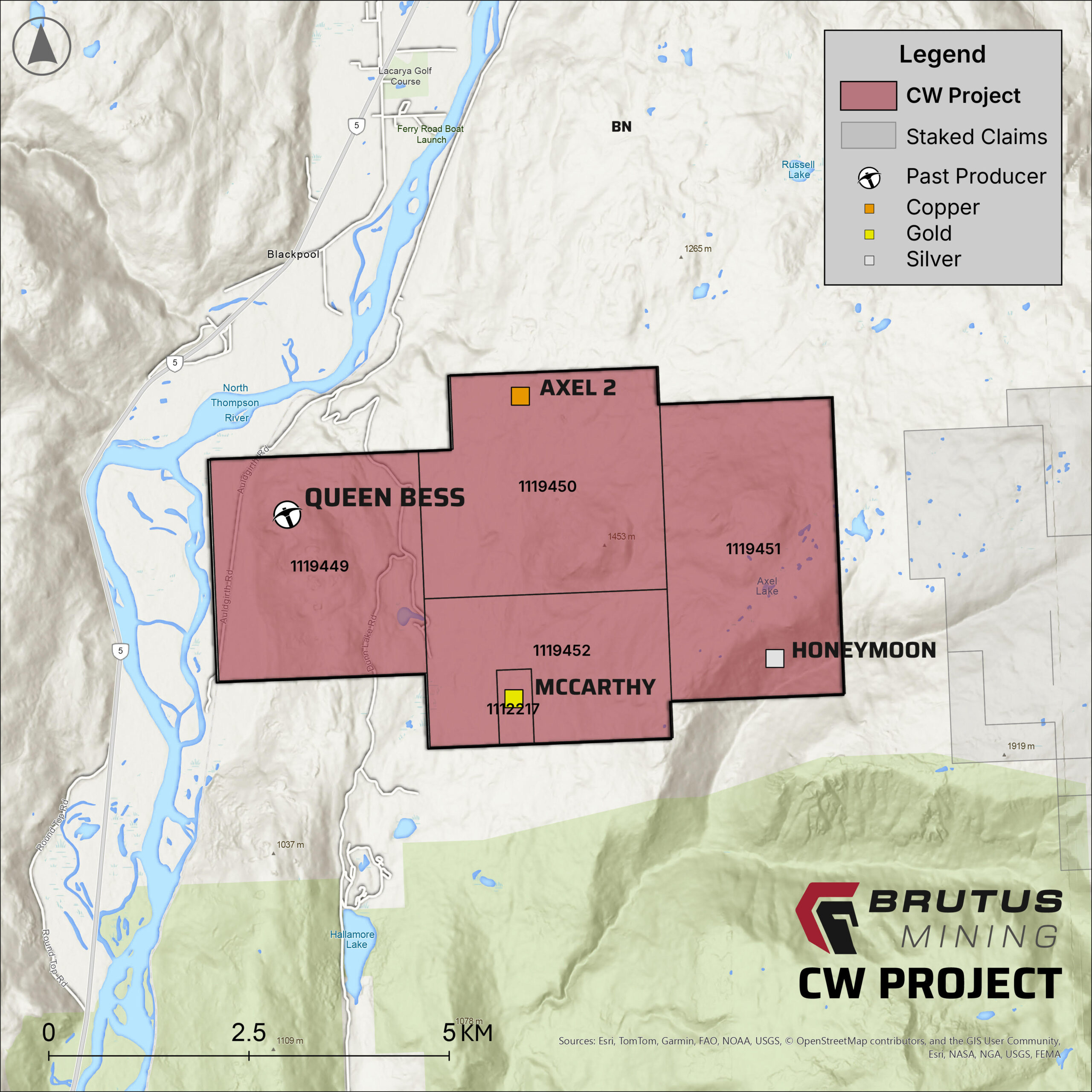
*Click to expand image
Five contiguous mineral claims (2,894.56 ha) located 100 km north of Kamloops in the Clearwater-Vavenby area. Option to earn 100% interest in the CW Property.
Hosted within Paleozoic metasedimentary and metavolcanic rocks of the Eagle Bay Assemblage and Fennell Formation, a belt prospective for both VMS and structurally controlled gold-bearing vein deposits.
Cu-Au ±Ag-Pb-Zn at five MINFILE showings. McCarthy trench: 6.6 m at 1.1% Cu, including 1.0 m at 2.24% Cu and 0.315 g/t Au (Teck, 1992). 2025 rock samples: trace to 4.91% Cu.
Excellent year-round access via Highway 5 and existing forest service roads. Kamloops (pop. 98,000) is a regional mining hub with full exploration services and contractors.
Source: NI 43-101 Technical Report on the CW Property, British Columbia, Derrick Strickland P.Geo., effective January 6, 2026.
Minfile 092P 187
incl. 1.0m @ 2.24% Cu &
0.315 g/t Au (Teck, 1992)
Trench C — 0.411 g/t Au
co-incident
Trench C — No published record of follow-up drill testing
2025 soils: Cu up to 1,230 ppm | Au up to 155 ppb on McCarthy Grid
Minfile 092P 174 — Polymetallic Quartz Veins
>200 g/t Ag | >1% Cu
20.8 g/t Ag—Area 2
North-striking mesothermal veins 2 cm–6 m wide; chalcopyrite, galena, sphalerite & native gold. Controlled by Fennell Formation structural fabric.
Minfile 092P 204/205—Disseminated to Massive Sulphide
Axel 2 grab (1991)
Rock sample 331679 (2025)
2025 Tower Grid soils: coincident Cu (408 ppm), Ni (308 ppm), Zn (840 ppm) & Au (80 ppb). Rock sample 331677: 5,430 ppm Cu (QP check assay 2,980 ppm).
Sources: NI 43-101 Technical Report on the CW Property, British Columbia —Derrick Strickland P.Geo., effective January 6, 2026. The scientific and technical information has been reviewed and approved by Luke van der Meer, P.Geo., a Qualified Person as defined by NI 43-101. Grab and select samples are selective in nature and are not representative of average grade or true width. Reported widths are sampled widths; true widths are not known.
The CW Property is located approximately 100 km north of Kamloops in the Clearwater-Vavenby area of south-central British Columbia, Canada.
The property consists of five contiguous mineral claims totaling 2,894.56 hectares.
Brutus Mining holds an option to acquire a 100% interest in the CW Property.
The property has excellent year-round access via Highway 5 and existing forest service roads. Kamloops is the nearest regional mining hub.
The claims are hosted within Paleozoic metasedimentary and metavolcanic rocks of the Eagle Bay Assemblage and Fennell Formation. The belt is prospective for both volcanogenic massive sulphide deposits and structurally controlled gold-bearing vein deposits.
Five Minfile showings have been identified, including the McCarthy showing (Minfile 092P 187), the Honeymoon showing (Minfile 092P 174) and the Axel 1 and Axel 2 showings (Minfile 092P 204/205). Mineralization styles range from polymetallic quartz veins to disseminated and massive sulphide, with Cu-Au±Ag-Pb-Zn.
Teck reported 6.6 m grading 1.1% Cu at the McCarthy showing in 1992, including 1.0 m grading 2.24% Cu and 0.315 g/t Au. A grab sample from Trench C returned 9.35% Cu with a co-incident 0.411 g/t Au, and Trench C averages 11.4 m grading 1.3% Cu, with no published record of follow-up drill testing. Soil sampling on the McCarthy Grid in 2025 returned copper up to 1,230 ppm and gold up to 155 ppb. The Honeymoon showing has reported 0.94 g/t Au with greater than 200 g/t Ag and greater than 1% Cu, and 2.9 g/t Au with 20.8 g/t Ag at Area 2. Rock sampling at the Axel showings returned up to 4.91% Cu in 2025.
Yes. The CW Property is covered by an NI 43-101 technical report authored by Derrick Strickland, P.Geo., with an effective date of January 6, 2026.
The scientific and technical information has been reviewed and approved by Luke van der Meer, P.Geo., a Qualified Person as defined by NI 43-101.
Sign up below to be notified of the latest news and updates from Brutus Mining Inc.